

Habitat menu
Habitat · preview
Home
Planning notices, events and alerts from across Aotearoa, in one place.
All of Aotearoa· change
Not an official warning service. For current warnings go to civildefence.govt.nz.
Headlines
You are looking at a preview
This is Habitat, the daily civic dashboard Digital Reef members get.
Everything on it is live, updated every few minutes. Reading is open to everyone. Opening a notice, setting your own area, saving an alert and choosing widgets take a free account.
River of News
Live from every source we follow · newest first
Summaries are written automatically and can be wrong: the source document is authoritative. This is not an official warning service. For current warnings go to civildefence.govt.nz; pilots should use IFIS for NOTAMs.

27 mins agoWest Coast
MTFJ - Grey District took home the Rising Star Award Date: 27 Oct 2026, 5:17 pm Categories: News The organisation’s first annual national awards for its role in helping a young job seeker achieve his
Grey District CouncilAutomated summaryThe Mayor’s Taskforce for Jobs (MTFJ) Grey District has been honoured with the Rising Star Award at its first annual national awards for helping a young job seeker, Riko Ellison, become a security guard. The recognition highlights the district’s efforts in providing training, licensing support and employment pathways for young people aged 16–24 within their communities. MTFJ Grey District was also acknowledged in the Top 10 Performance Award category.
 General NotificationPublic Notices

37 mins agoCanterbury
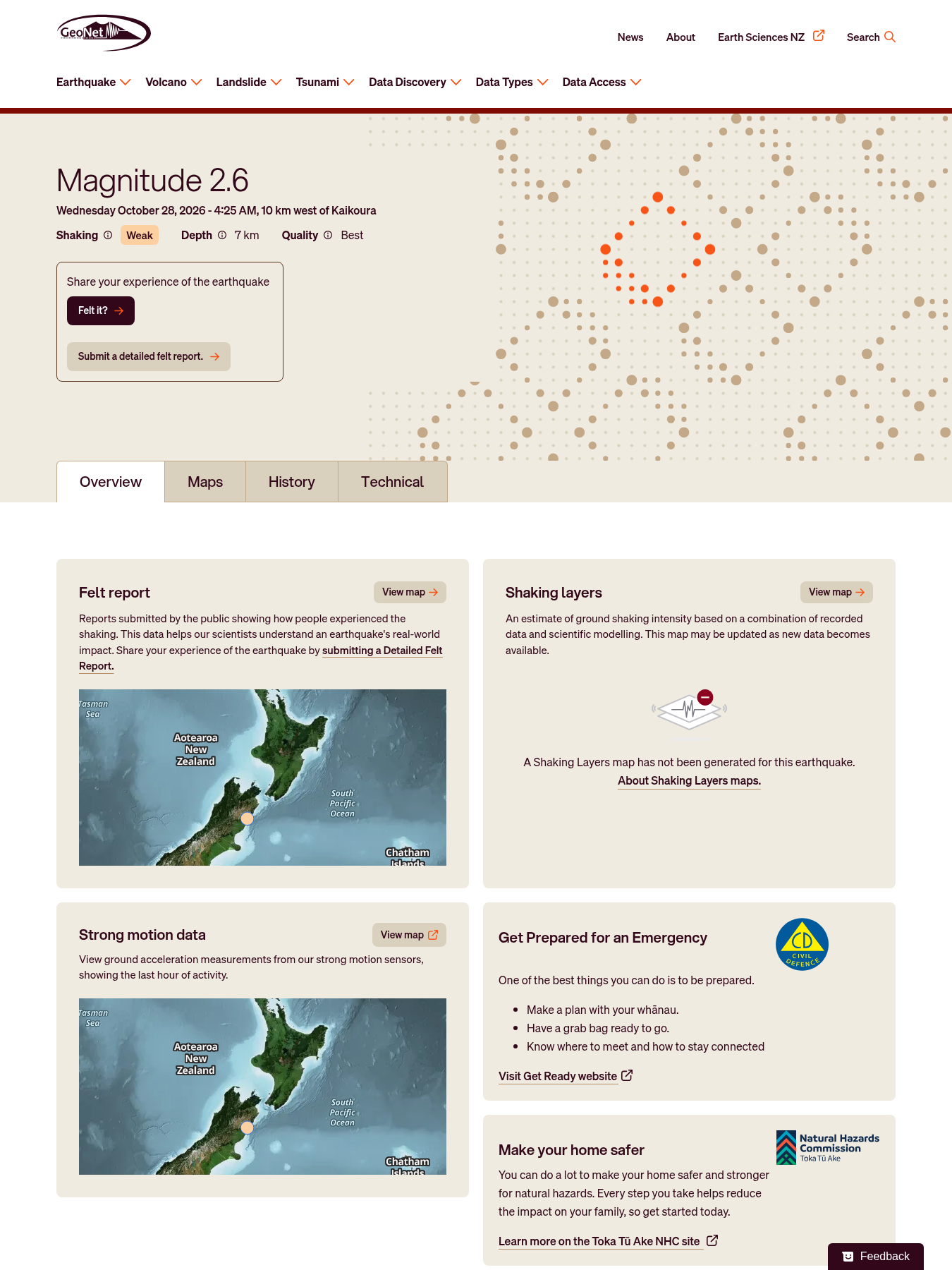
MinorM2.6 earthquake — 10 km west of Kaikoura
Automated summaryA brief bulletin reporting a magnitude 2.6 earthquake located 10 km west of Kaikoura, with a depth of 7 km and the highest Mercalli intensity of MMI 3. The notice confirms the event’s parameters and its locally assessed impact level.
 Natural HazardsEmergency Management

1 hour agoNorthland
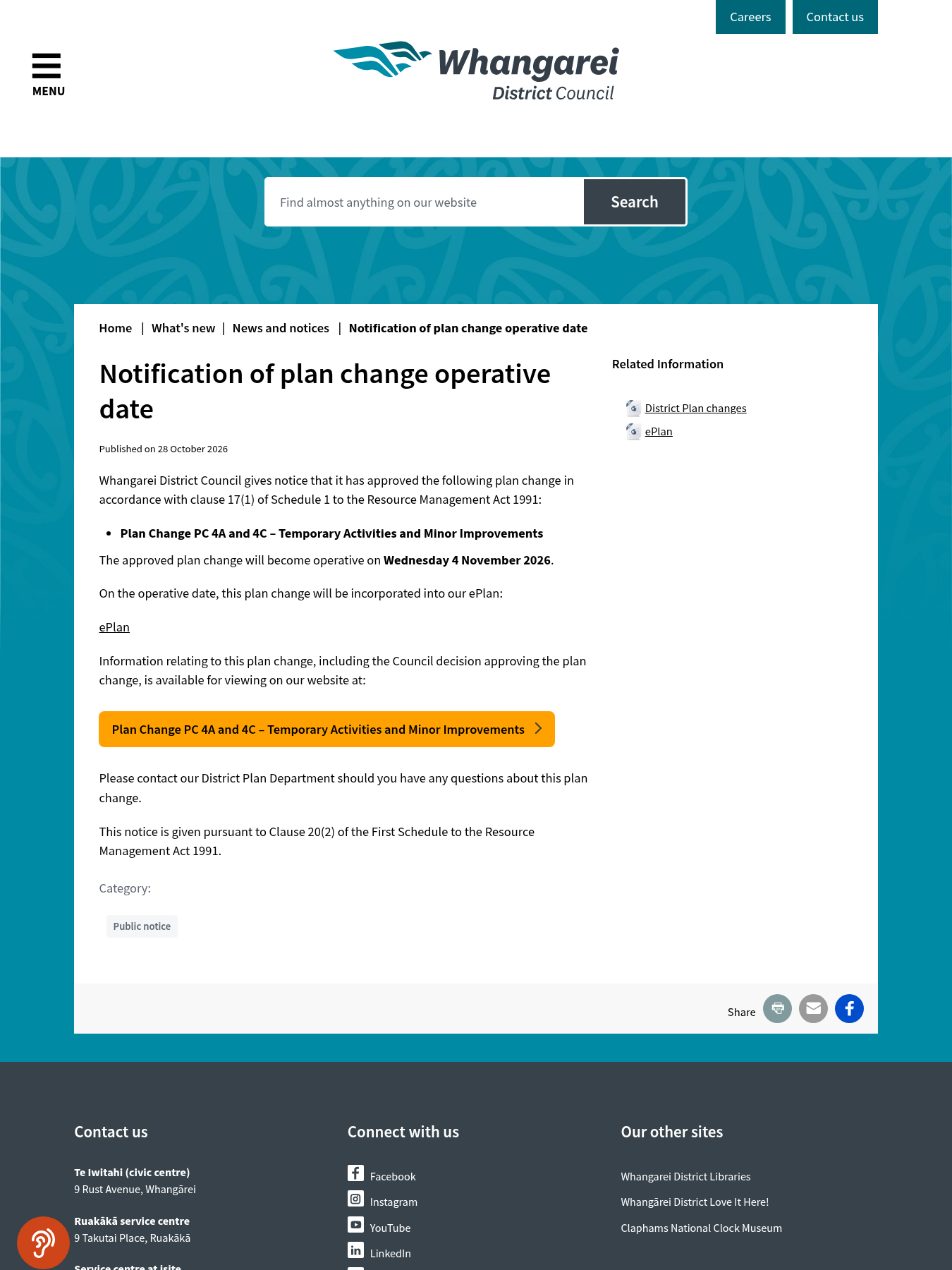
Notification of plan change operative date Published on 28 October 2026 Council has approved Plan Change 4A and 4C – TemporaryActivities and Minor Improvements in accordance with clause 17(1) of Sched
Whangarei District CouncilAutomated summaryWhangarei District Council has approved the plan change PC 4A and 4C – Temporary Activities and Minor Improvements, which will become operative on 4 November 2026. The decision is announced in this notice and the details are available on the council’s ePlan website.
 Plan ChangeDecisionPublic Notices
 ×11
1 hour ago
OIA responses11 OIA responses
Show all 11
1 hour agoOtago
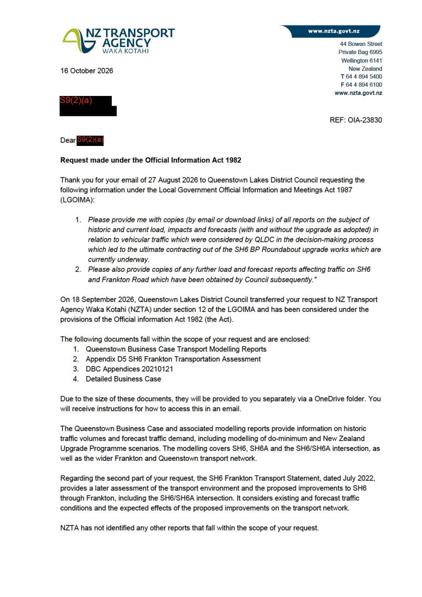
OIA-23830 SH6 BP Roundabout Upgrade Traffic Assessment Reports
Waka Kotahi NZ Transport Agency (NZTA)Automated summaryAn official response to an Official Information Act request, providing links to traffic modelling reports, a transport assessment, and a business case related to the SH6 roundabout upgrade in Queenstown Lakes District. The letter also outlines which information was withheld and informs the requester of their right to appeal under the Ombudsman. The correspondence is addressed to a council member seeking transport data that affected the council’s decision to contract out the upgrade works.
 TransportOIA ResponseCorrespondenceOIA Responses
1 hour ago
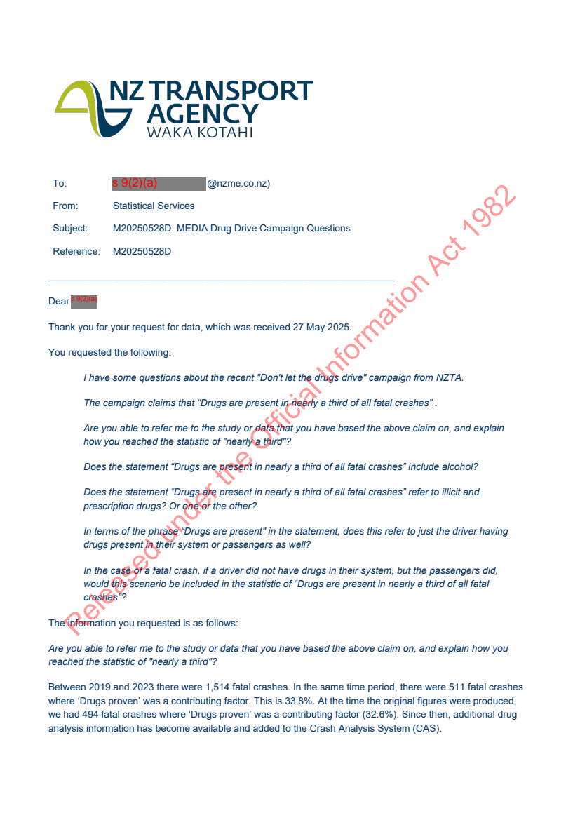
OIA-23846 Drug Impairment and Fatal Crash Data
Waka Kotahi NZ Transport Agency (NZTA)Automated summaryThis correspondence is an Official Information Act response from the NZ Transport Agency Media unit to an inquiry about the "Don't let the drugs drive" campaign. It provides detailed drug‑related statistics for fatal crashes between 2019 and 2023, explains how the figures were derived, clarifies what is considered a drug, and addresses specific questions about data definitions and methodology.
 TransportOIA ResponseCorrespondenceOIA Responses
1 hour ago
OIA-23846 Drug Impairment and Fatal Crash Data
Waka Kotahi NZ Transport Agency (NZTA)Automated summaryThe attachment presents a comprehensive analysis of drug‑related deaths and serious injuries in New Zealand road crashes from 2013/14 to 2022/23, detailing trends, demographic breakdowns, types of drugs involved, road user categories, and geographic distribution. It compiles data from the CAS database, highlights the increase in drug‑contributing crashes, and compares drug involvement to alcohol and speed factors.
 TransportHealthOIA ResponseExpert ReportOIA Responses
1 hour ago
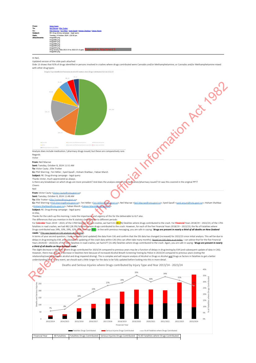
OIA-23846 Drug Impairment and Fatal Crash Data
Waka Kotahi NZ Transport Agency (NZTA)Automated summaryThe email chain provides updated statistics on how drugs have contributed to road crash fatalities, noting that around a third of all deaths were drug-related between 2019 and 2023. It discusses data sources, comparability with alcohol data, and clarifies that cannabis and methamphetamine are the most common drugs detected. The response consolidates requested figures for use in the Department’s upcoming drug driving campaign.
 TransportHealthOIA ResponseCorrespondenceOIA Responses
1 hour ago
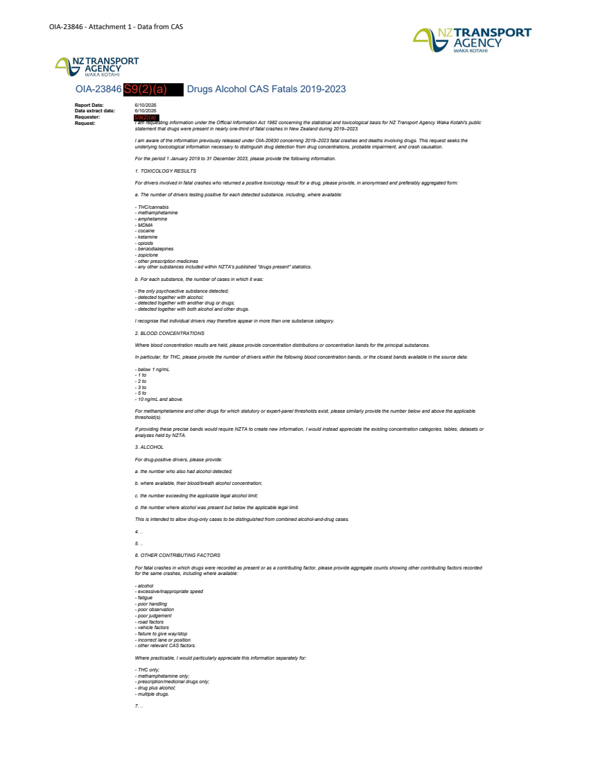
OIA-23846 Drug Impairment and Fatal Crash Data
Waka Kotahi NZ Transport Agency (NZTA)Automated summaryNZ Transport Agency Waka Kotahi provides anonymised aggregated toxicology and crash data for 2019‑2023 fatal crashes in response to an Official Information Act request, detailing drug and alcohol findings, concentration bands, contributing factors and associated statistics.
 TransportHealthOIA ResponseOIA Responses
1 hour ago
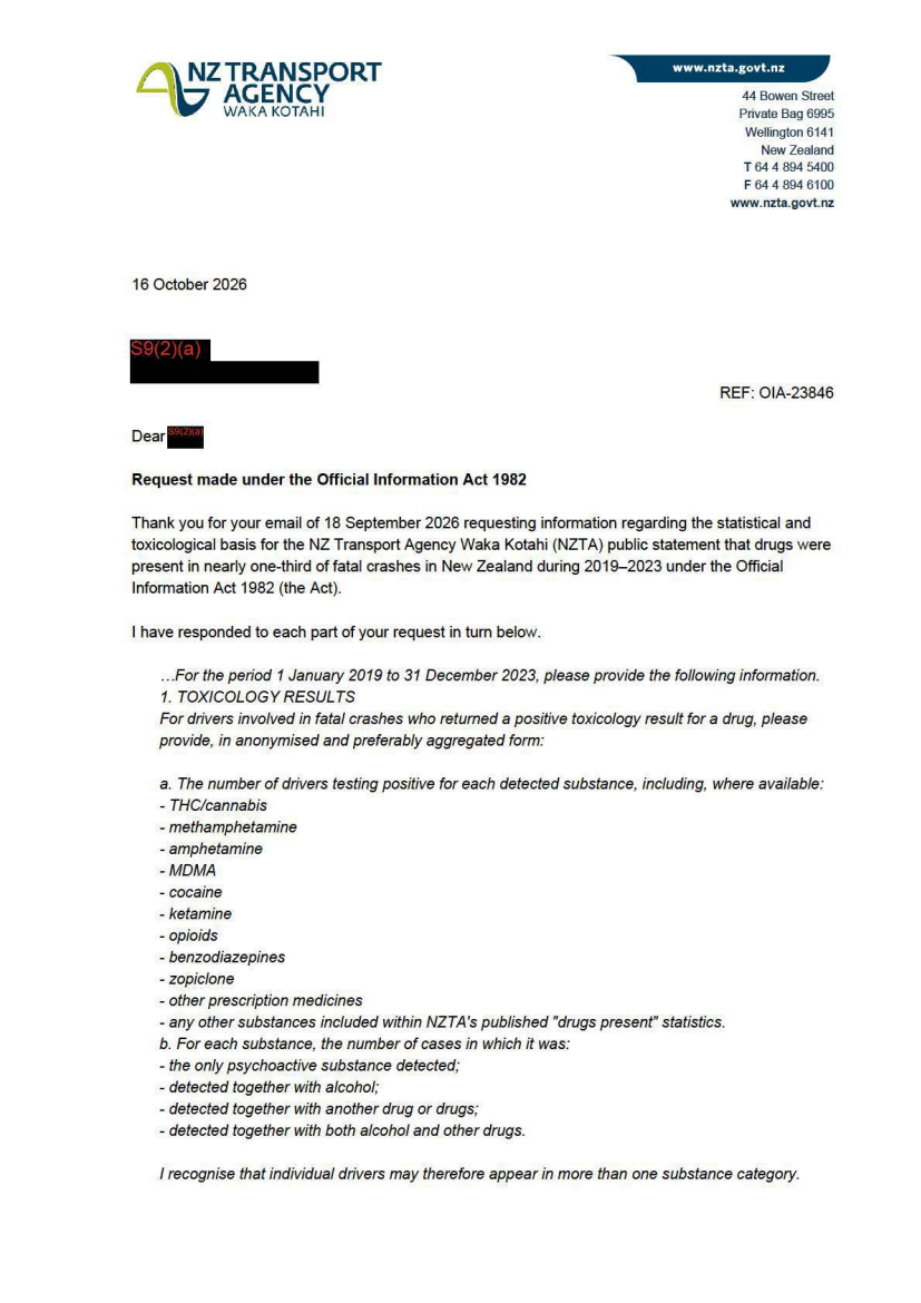
OIA-23846 Drug Impairment and Fatal Crash Data
Waka Kotahi NZ Transport Agency (NZTA)Automated summaryThe NZ Transport Agency releases the requested statistical and toxicological data on drug presence in fatal crashes from 2019‑2023, explains its data sources and limits, and outlines how it informs its advertising statement that drugs appear in about a third of fatal crashes. It also notes data withheld under privacy and privilege provisions and refers to relevant internal documents. No decision or permit is issued; it is a record of the information provided under the Official Information Act.
 TransportHealthOIA ResponseCorrespondenceOIA Responses
1 hour agoOtago
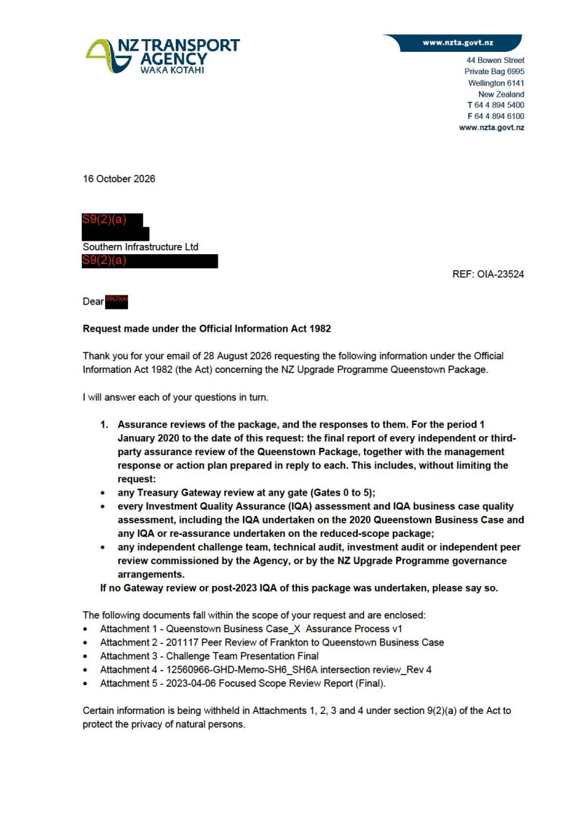
OIA-23524 Queenstown Package Scope Reduction and Benefits Assessment
Waka Kotahi NZ Transport Agency (NZTA)Automated summaryThe letter from the NZ Transport Agency, submitted under the Official Information Act, details the documents provided in response to a request about the Queenstown transport upgrade package, covering assurance reviews, board decisions, cost estimates, benefits realisation and strategic plans, and specifies which items are supplied, withheld or refused and why. It notes that some requested documents have already been publicly released or are unavailable, and it cites the relevant OIA sections for any refusals or withholdings. The correspondence clarifies the status of each requested element and outlines the information held by the agency.
 TransportInfrastructureGovernanceWater SupplyOIA ResponseCorrespondenceOIA Responses
1 hour agoWellington
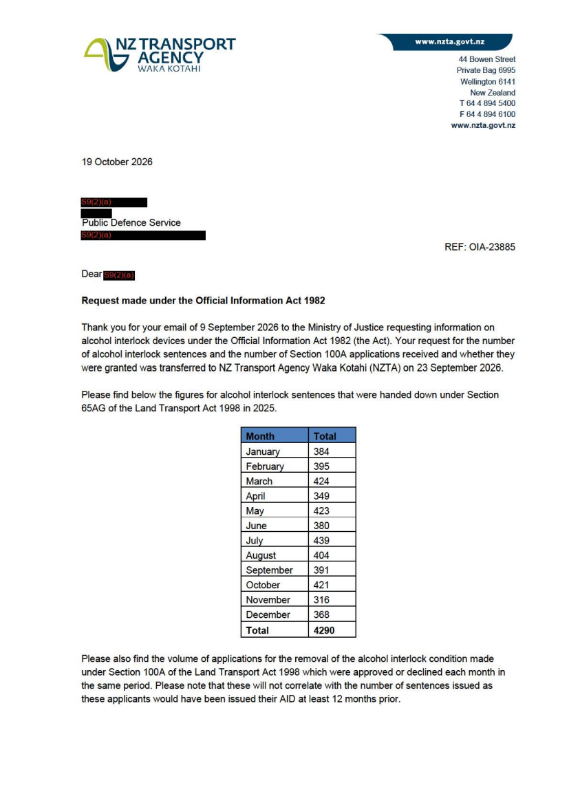
OIA-23885 Alcohol Interlock and Section 100A Statistics
Waka Kotahi NZ Transport Agency (NZTA)Automated summaryThe NZ Transport Agency’s response letter, filed under the Official Information Act 1982, provides 2025 data on alcohol interlock sentences (total 4,290) and monthly figures for Section 100A applications for removal of the interlock condition (total 1,480). It notes that the figures will be anonymised and published on the agency’s website and offers contact details for further discussion.
 TransportOIA ResponseCorrespondenceOIA Responses
1 hour ago
OIA-23871 Safety camera infringement data
Waka Kotahi NZ Transport Agency (NZTA)Automated summaryThe document is a data extract showing monthly traffic speed‑camera infringements recorded by the New Zealand Transport Agency across Auckland, Waikato, Bay of Plenty, Otago, and other regions for 2026. It lists offence volumes by speed band, road, and month, providing a snapshot of enforcement activity and the current deployment of speed cameras.
 TransportInfrastructureOIA ResponseCorrespondenceOIA Responses
1 hour ago
OIA-23932 Warrant and Certificate of Fitness (WoF and CoF) fail reasons and the VIRM
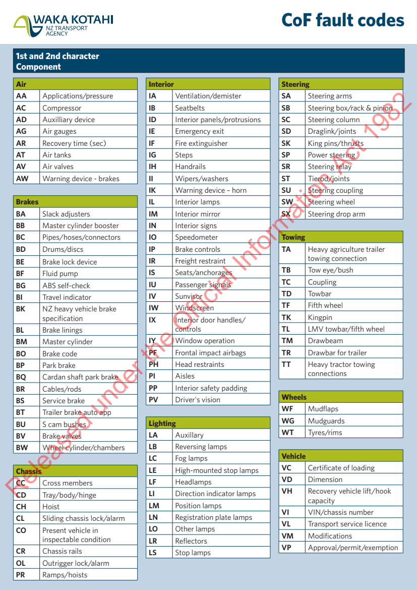
Waka Kotahi NZ Transport Agency (NZTA)Automated summaryThis document lists the fault codes used by the Commission of Fuel (CoF) for vehicle inspection, cataloguing components, fault locations, and required actions. It serves as a technical reference for vehicle safety compliance and inspection records.
 TransportOIA ResponseCorrespondenceOIA Responses
1 hour ago
OIA-23932 Warrant and Certificate of Fitness (WoF and CoF) fail reasons and the VIRM
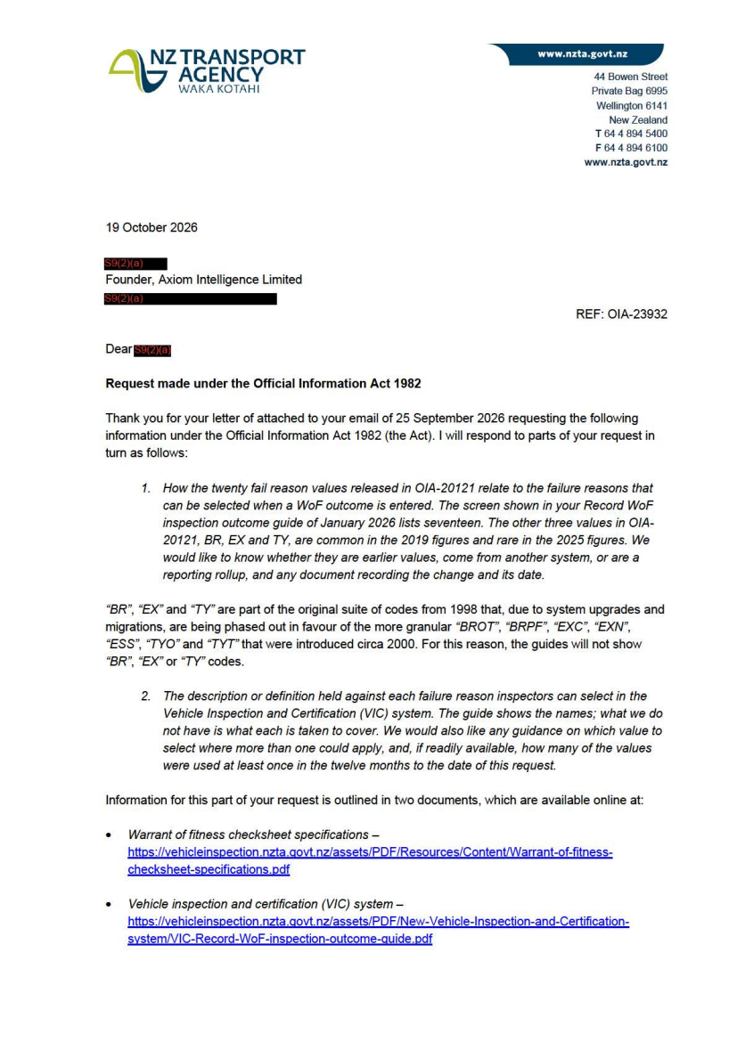
Waka Kotahi NZ Transport Agency (NZTA)Automated summaryA formal response from the New Zealand Transport Agency (NZTA) to an Official Information Act request, outlining which parts of the requested data are released, which are refused due to lack of availability or the resource cost of provision, and citing procedural grounds for refusal. It lists specific vehicle inspection codes, references published guides, and notes the right to lodge a complaint with the Ombudsman.
 OIA ResponseCorrespondenceOIA Responses
- OIA-23830 SH6 BP Roundabout Upgrade Traffic Assessment Reports
- OIA-23846 Drug Impairment and Fatal Crash Data
- OIA-23846 Drug Impairment and Fatal Crash Data
- OIA-23846 Drug Impairment and Fatal Crash Data
- OIA-23846 Drug Impairment and Fatal Crash Data
- OIA-23846 Drug Impairment and Fatal Crash Data
- OIA-23524 Queenstown Package Scope Reduction and Benefits Assessment
- OIA-23885 Alcohol Interlock and Section 100A Statistics
- OIA-23871 Safety camera infringement data
- OIA-23932 Warrant and Certificate of Fitness (WoF and CoF) fail reasons and the VIRM
- OIA-23932 Warrant and Certificate of Fitness (WoF and CoF) fail reasons and the VIRM
TransportHealthInfrastructureGovernanceWater SupplyOIA ResponseCorrespondenceExpert ReportOIA Responses1 hour agoWellington
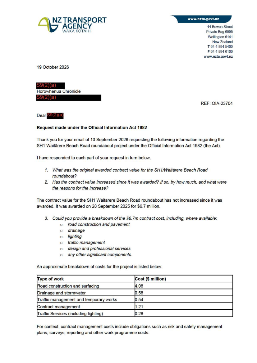
OIA-23704 SH1/Waitārere Beach Road roundabout cost breakdown
Waka Kotahi NZ Transport Agency (NZTA)Automated summaryA formal response letter under the Official Information Act details the cost breakdown, contract value, and scope of the SH1 Waitarere Beach Road roundabout project, affirming that the contract value remains unchanged since award and providing approximate cost allocations for road construction, drainage, lighting, traffic management, and related works.
 InfrastructureGeneral NotificationCorrespondenceOIA Responses
1 hour ago
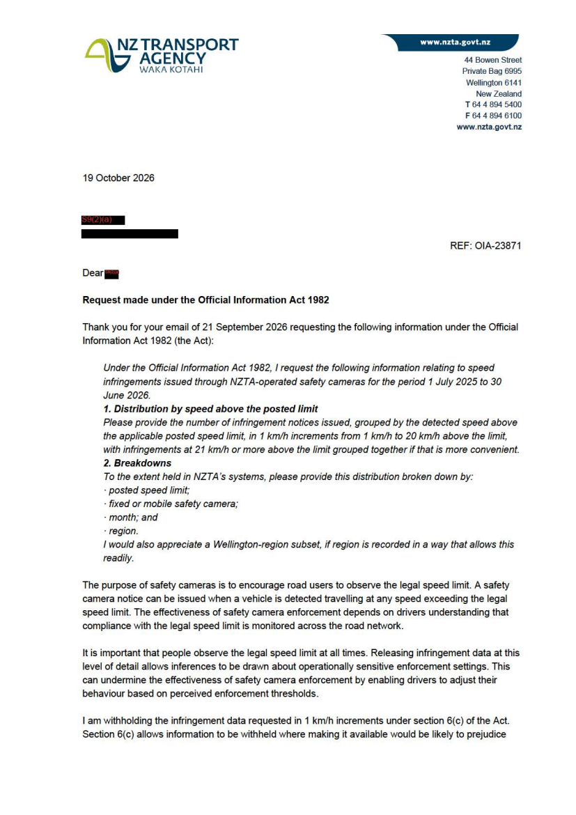
OIA-23871 Safety camera infringement data
Waka Kotahi NZ Transport Agency (NZTA)Automated summaryThis letter responds to an Official Information Act request, providing aggregated data on speed‑infringement notices issued by NZTA safety cameras for a specified period, with a note that certain detailed data is withheld under the Act.
 TransportGeneral NotificationCorrespondenceOIA Responses
1 hour ago
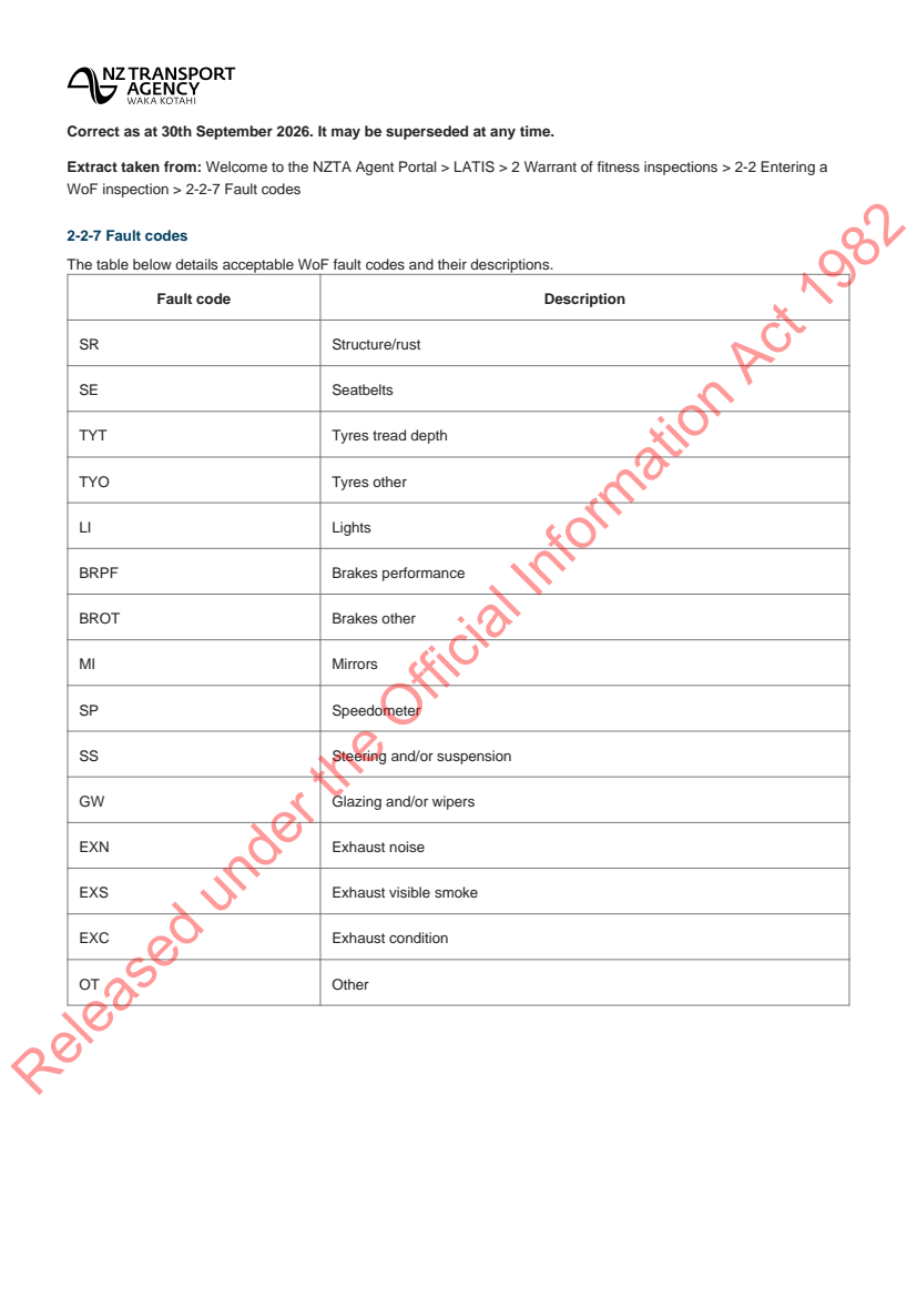
OIA-23932 Warrant and Certificate of Fitness (WoF and CoF) fail reasons and the VIRM
Waka Kotahi NZ Transport Agency (NZTA)Automated summaryA table outlining the acceptable Warrant of Fitness (WoF) fault codes used by the NZ Transport Agency for vehicle inspections, along with brief descriptions of each code. It is presented as part of an Official Information Act response, indicating that the information is publicly released and routinely updated. The table covers components such as structure, seatbelts, tyres, brakes, mirrors, steering and exhaust among others.
 TransportGeneral NotificationOIA Responses

1 hour agoCanterbury
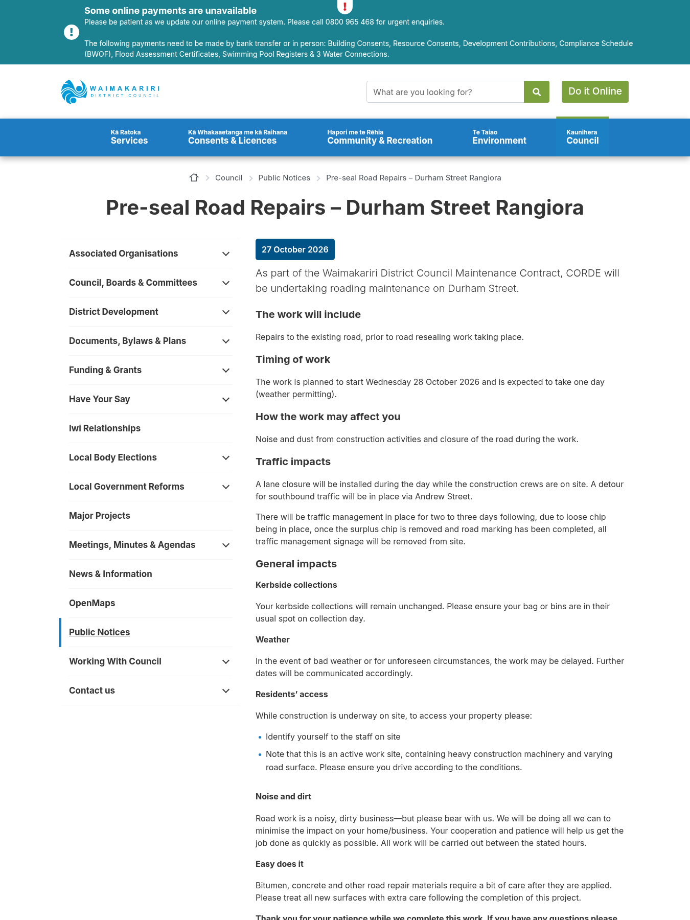
27 October Pre-seal Road Repairs – Durham Street Rangiora As part of the Waimakariri District Council Maintenance Contract, CORDE will be undertaking roading maintenance on Durham Street.
Waimakariri District CouncilAutomated summaryThe Waimakariri District Council and contractor CORDE will carry out pre‑seal road repairs on Durham Street in Rangiora, commencing 28 October 2026. A single lane will be closed for a day, with a detour via Andrew Street and traffic management for several days following the work. Residents will experience noise, dust and temporary road access restrictions during the project.
 TransportInfrastructureRoad StoppingCorrespondencePublic Notices

1 hour agoNorthland
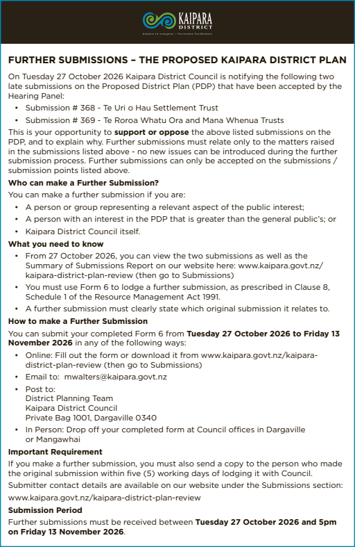
Further Submissions Notification - Proposed Kaipara District Plan - Kaipara Lifestyler
Kaipara District CouncilAutomated summaryKaipara District Council has accepted two late submissions for the Proposed Kaipara District Plan and is inviting further submissions. The notice outlines the submission period, the required Form 6, and how to lodge further comments and who is eligible to submit.
 Land UseGovernancePlan ChangeCorrespondencePublic Notices
1 hour agoHawke's Bay
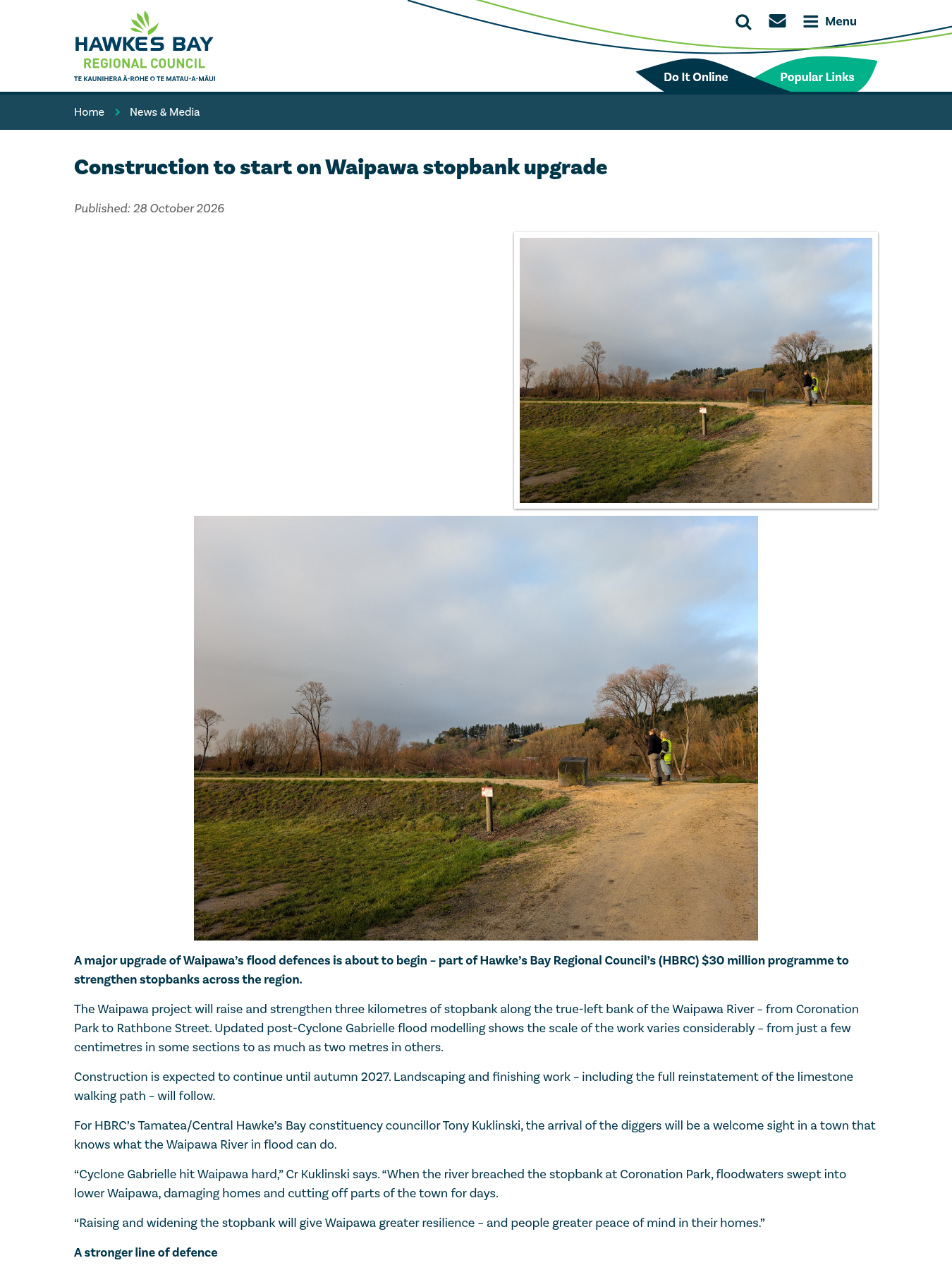
Construction to start on Waipawa stopbank upgrade
Hawke's Bay Regional CouncilAutomated summaryThe Hawke's Bay Regional Council announces that construction of a three‑kilometre stopbank upgrade on the Waipawa River will commence to raise and widen existing flood defences, based on updated post‑Cyclone Gabrielle flood modelling. The project, part of a $30 million North Island Weather Event resilience programme, is expected to finish by autumn 2027 and will use locally sourced gravel to strengthen the river system.
 FreshwaterClimateGeneral Notification
1 hour agoManawatū-Whanganui
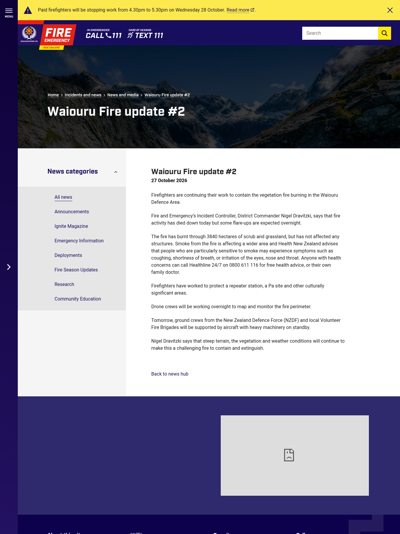
Waiouru Fire update #2
Fire and Emergency New ZealandAutomated summaryThe Department of Fire and Emergency provides a status update on the ongoing Waiouru vegetation fire, noting containment progress, area burned, and expectations of flare-ups, while advising the public on smoke-related health risks.
 Natural HazardsHealthEmergency Management
2 hours agoCanterbury
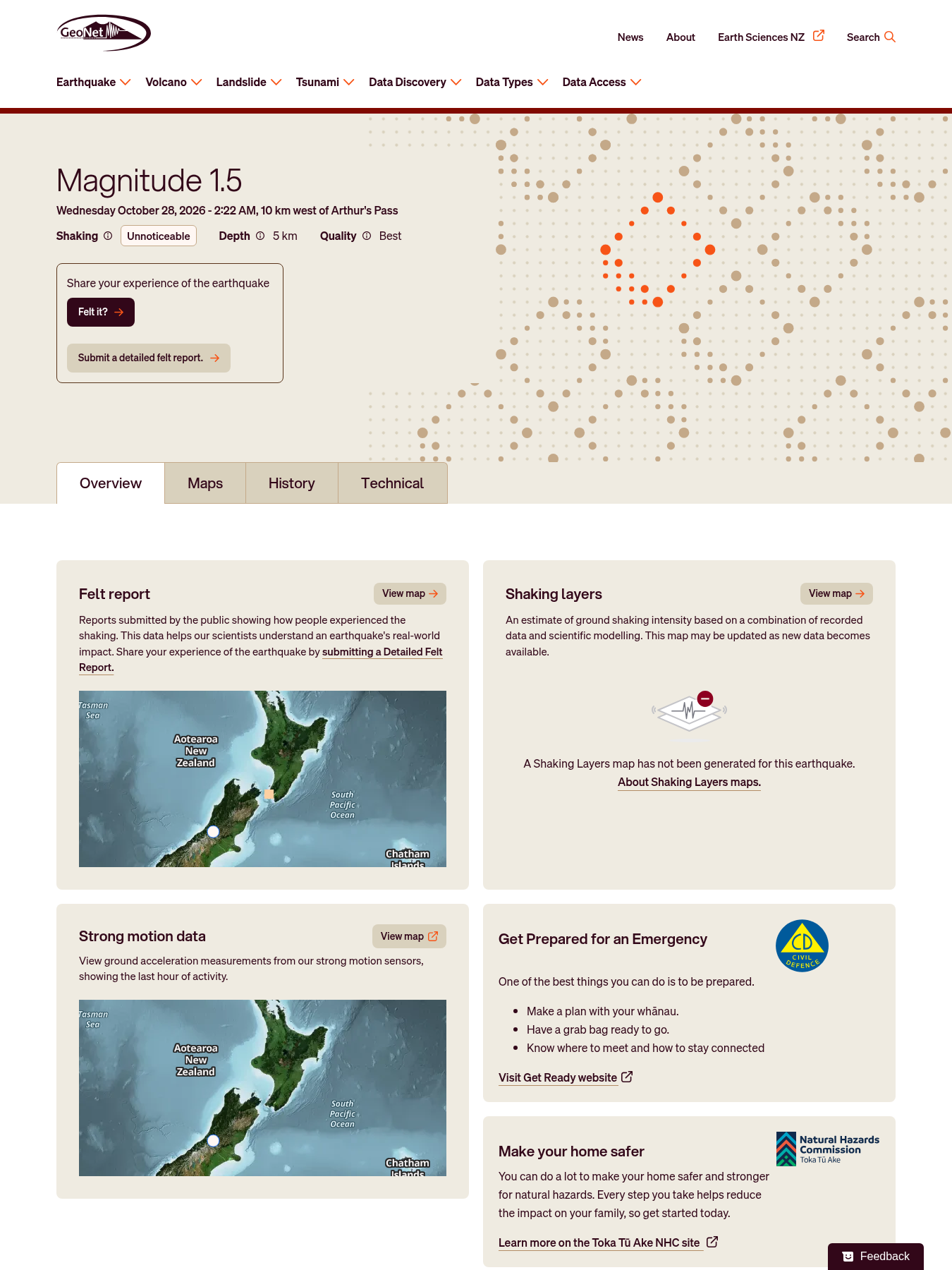
MinorM2.4 earthquake — 10 km west of Arthur's Pass
Automated summaryThe alert records a 2.4‑scale earthquake that occurred approximately 10 km west of Arthur's Pass, at a depth of 10 km with a Modified Mercalli Intensity of 3. It was automatically detected and serves as an official notification of the seismic event.
 Natural HazardsEmergency ManagementCorrespondence

4 hours agoNorthland
Website Alerts - Agendas and Minutes
Northland Regional CouncilAutomated summaryAn email alert to subscribers informs them that the Northland Regional Council has just published new meeting agendas on its website. The update lists the Joint WDC‑NRC Whangarei Public Transport Working Party and the Regional Transport Committee, both scheduled for 29 October.
 TransportGovernanceGeneral NotificationCorrespondence

6 hours agoCanterbury
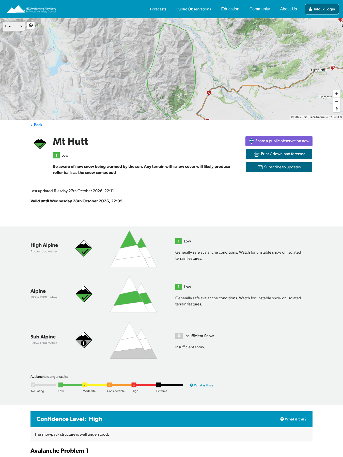
Mt Hutt avalanche forecast posted
New Zealand Mountain Safety CouncilAutomated summaryA new avalanche forecast for Mt Hutt has been posted by the New Zealand Avalanche Advisory Service. The notification informs users that updated mountain‑safety information is now available.
 Natural HazardsPublic AccessRecreationGeneral NotificationCorrespondence
6 hours agoWest Coast
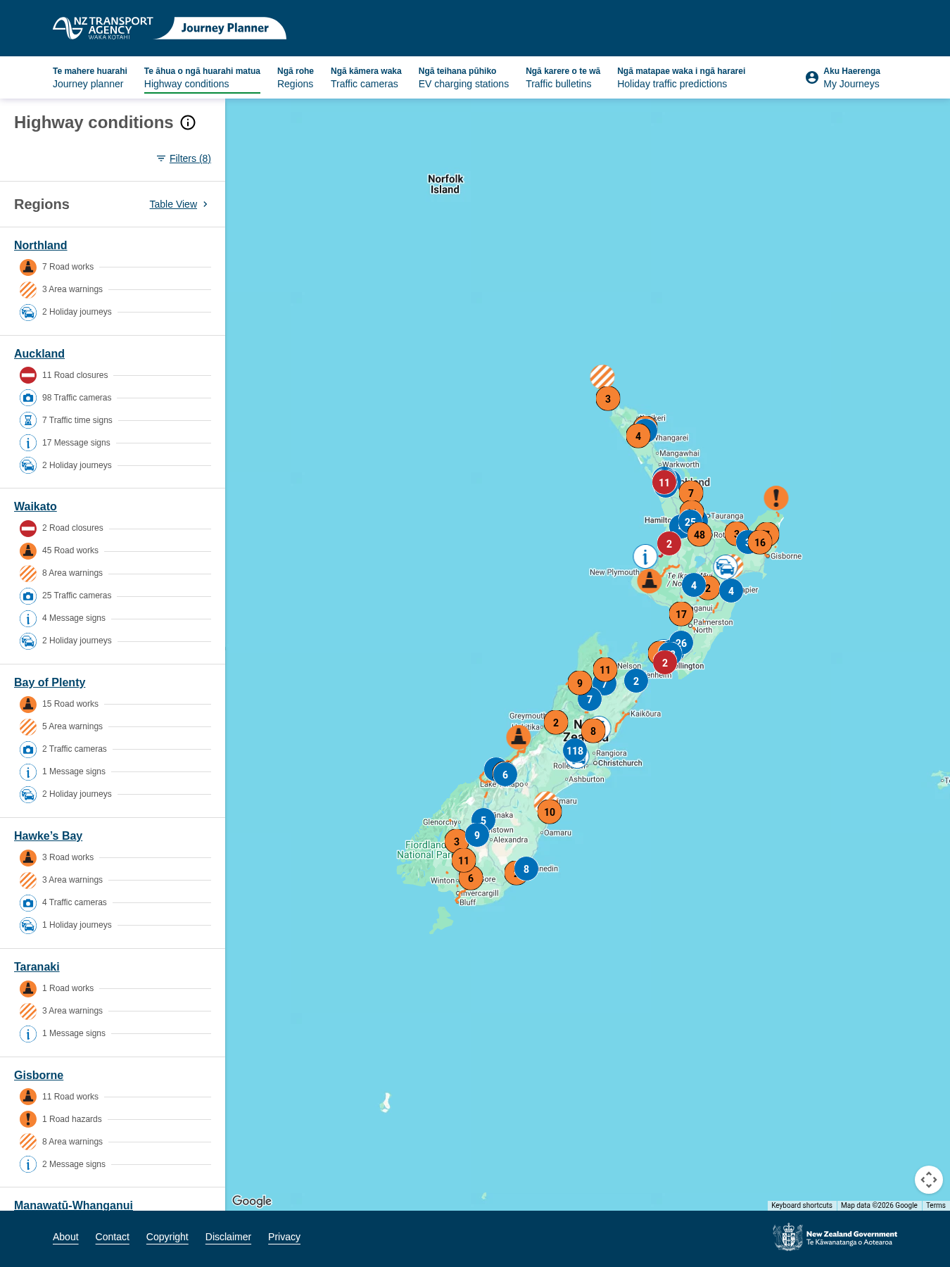
SevereRoad Closure: SH 20A Full Closure Kirkbride Rd to SH20 (incl link to SH20), Northbound
Automated summaryThis notice announces the full northbound closure of SH 20A between Kirkbride Rd and SH 20 for maintenance, directing motorists to use a posted detour and to anticipate delays. It specifies that the closure will last until 28 Oct 2026 5:00 am, when the road is expected to reopen.
 TransportInfrastructurePublic AccessRoad StoppingDecision
6 hours agoWest Coast
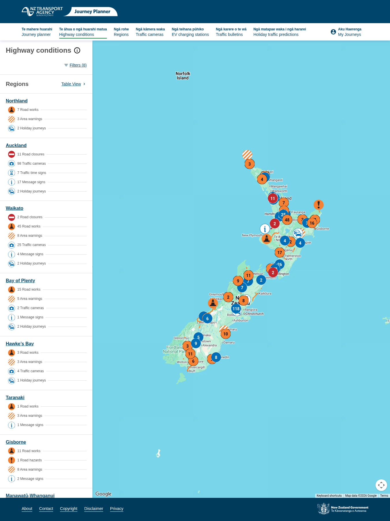
SevereRoad Closure: SH 20 Full Closure Massey Rd to Rimu Rd, Northbound
Automated summaryThe maintenance authority has announced a full closure of State Highway 20 between Massey Road and Rimu Road for the northbound direction. Drivers are advised to follow the detour signage and allow extra travel time until the closure ends on 28 Oct 2026 at 5:00 am.
 InfrastructureTransportRoad StoppingDecision
7 hours agoAuckland
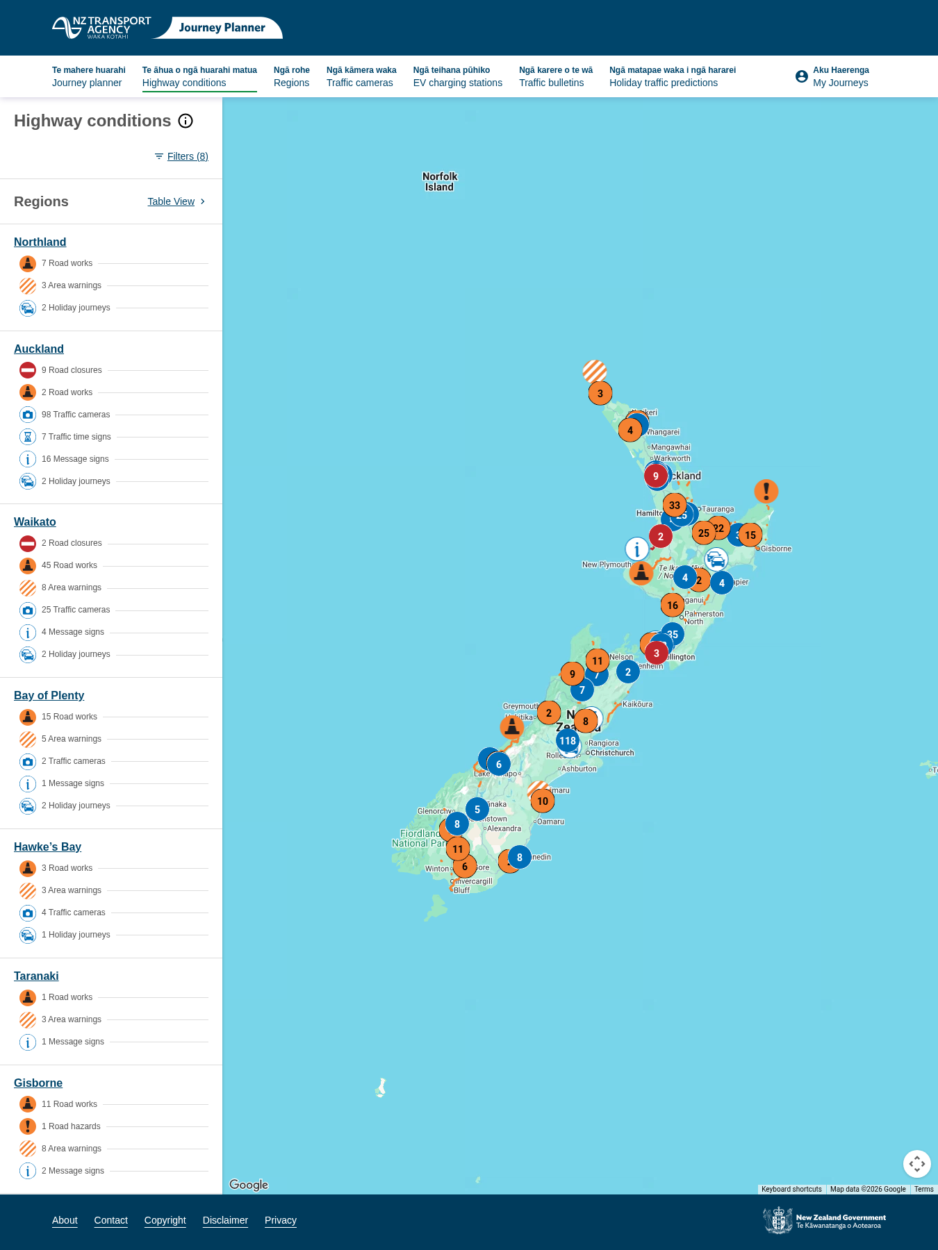
SevereRoad Closure: SH 1 Silverdale On-ramp Southbound
Automated summaryRoad closure announced for the southbound on‑ramp of State Highway 1 at Silverdale due to maintenance, effective until 28 Oct 2026. Drivers are directed to follow the posted detour and allow extra travel time.
 TransportInfrastructureRoad StoppingDecision
7 hours agoAuckland
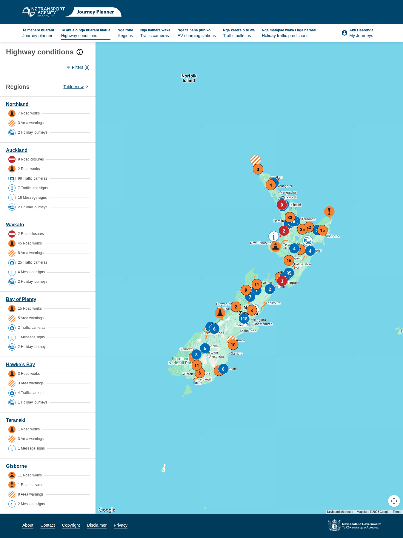
SevereRoad Closure: SH 1 Full Closure Silverdale to Oteha Valley Rd, Southbound
Automated summaryA temporary full closure of Southbound State Highway 1 from Silverdale to Oteha Valley Road is announced to allow maintenance work, with travellers advised to detour and anticipate delays until the closure is lifted on 28 Oct 2026.
 TransportInfrastructureRoad Stopping
7 hours ago
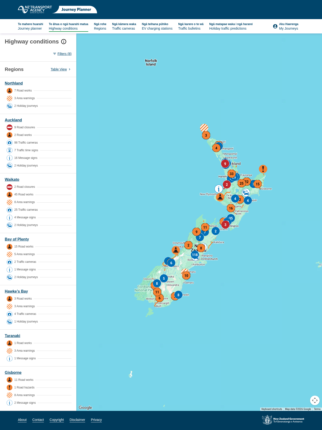
SevereRoad Closure: SH 20 Coronation Rd On-ramp Northbound
Automated summaryA road closure on the southbound on‑ramp of SH 20 at Coronation Rd has been announced, with motorists directed to follow a posted detour. The closure is expected to last until 28 Oct 2026 5:00 am, and additional traffic delays may occur during this period.
 TransportRoad StoppingDecision
7 hours agoCanterbury
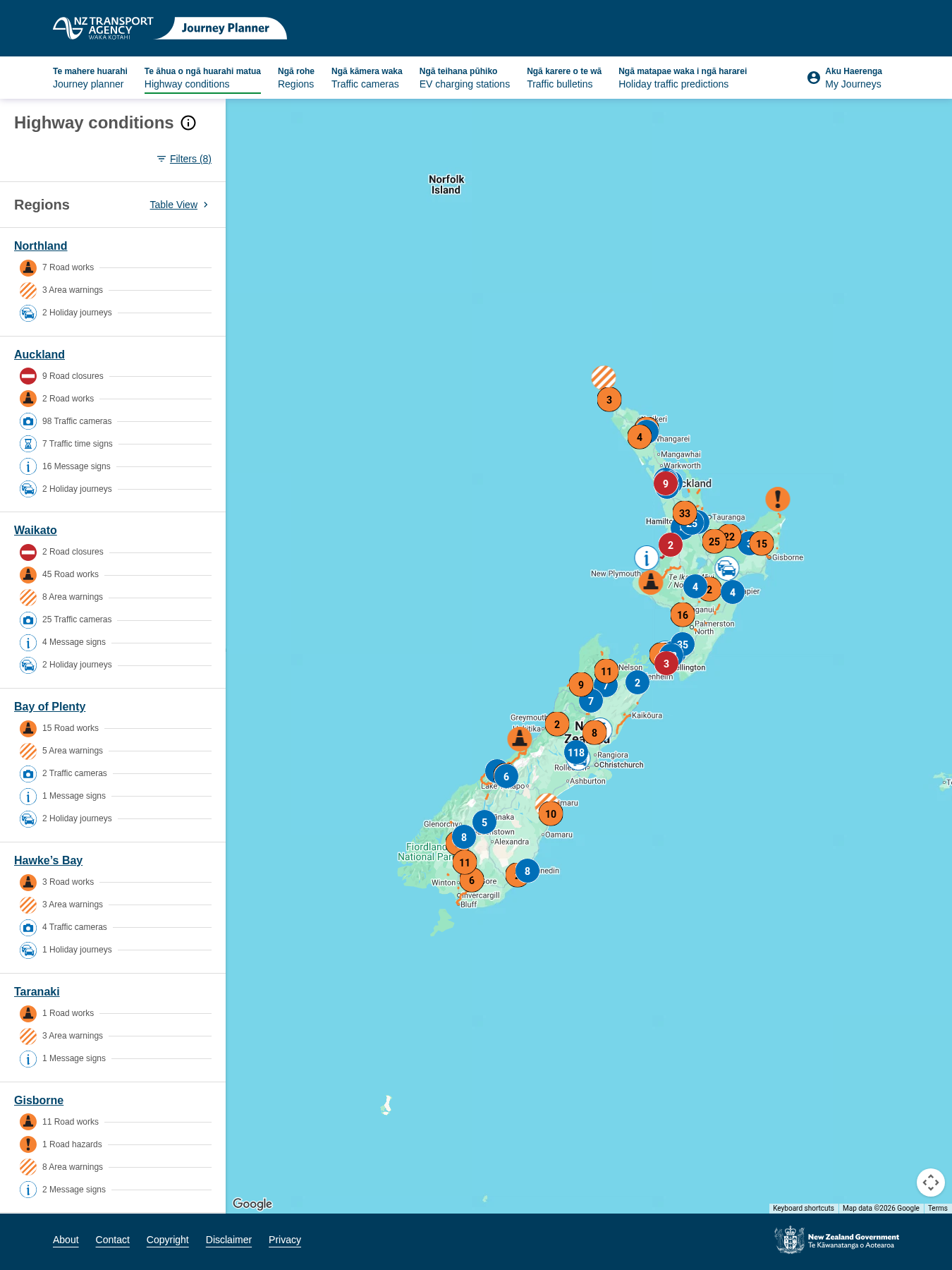
SevereRoad Closure: SH 20A Kirkbride Rd On-ramp Northbound
Automated summaryA temporary road closure is announced for the northbound on‑ramp of SH 20A at Kirkbride Road for maintenance, with a detour signposted and projects to be lifted on 28 Oct 2026 at 5:00 am.
 TransportInfrastructureRoad StoppingDecision
7 hours agoAuckland
SevereRoad Closure: SH 20 Massey Rd On-ramp Northbound
Automated summaryThis notice provides information that the northbound on‑ramp onto SH 20 Massey Road is closed for maintenance. The closure will remain in effect until 28 Oct 2026 5:00 am, and drivers are advised to follow posted detours and allow for extra travel time.
 TransportInfrastructureEmergency ManagementDecision
7 hours agoAuckland
SevereRoad Closure: SH 1 Papakura On-ramp (Diamond) Southbound
Automated summaryA temporary road closure has been declared on the southbound Papakura on‑ramp (diamond) on State Highway 1, due to maintenance activities. Drivers are urged to use a posted detour and allow added travel time until the closure is lifted on 28 Oct 2026.
 TransportInfrastructureRoad StoppingDecision
7 hours agoAuckland
SevereRoad Closure: SH 1 Full Closure Papakura to Drury, Southbound
Automated summaryThe notice announces a full closure of State Highway 1 between Papakura and Drury for southbound traffic as part of maintenance, advising drivers to follow the posted detour and allowing extra travel time. The closure is expected to be resolved by 28 Oct 2026 at 5:00 am.
 InfrastructureRoad StoppingDecision
7 hours agoAuckland
SevereRoad Closure: SH 1 Papakura On-ramp (Loop) Southbound
Automated summaryThis notice declares that the southbound on‑ramp loop of State Highway 1 in Papakura is closed for maintenance, with an expected reopening on 28 Oct 2026 5:00 am. Drivers are advised to use posted detours and allow extra travel time due to delays.
 InfrastructureTransportRoad StoppingDecision
7 hours agoAuckland
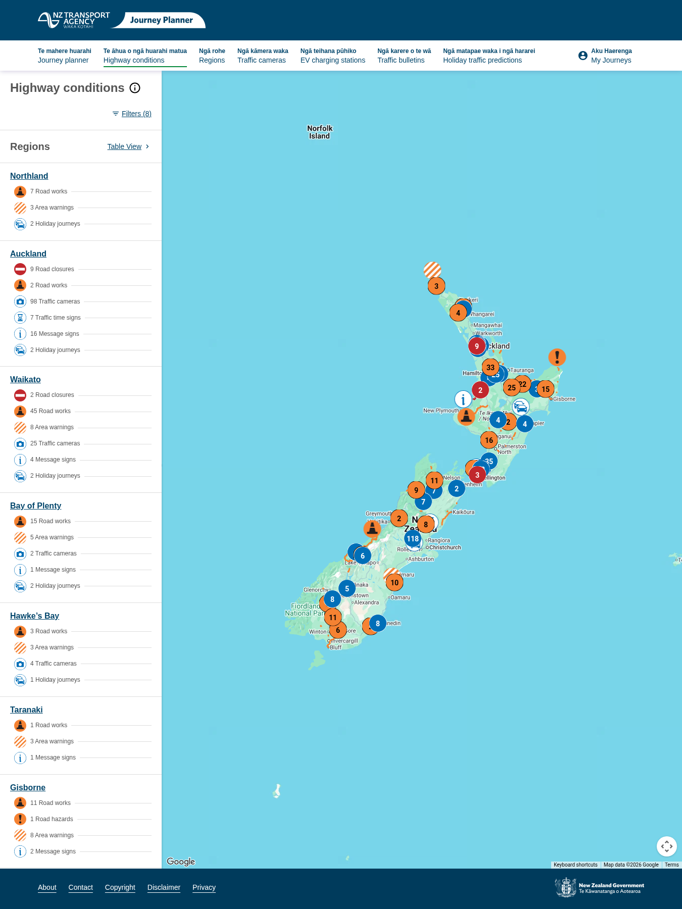
SevereRoad Closure: SH 1 Highbrook Dr On-ramp Southbound
Automated summaryThis notice announces the temporary closure of the southbound entry to Highbrook Drive on State Highway 1 due to maintenance work, with a detour provided and an expected reopening date of 28 October 2026. Drivers are advised to follow the detour signage and allow extra travel time.
 TransportInfrastructureRoad StoppingDecision
8 hours agoNelson
MinorArea Warning: SH 2 Whakamarama to Te Puna
Automated summaryA traffic management notice informs drivers that stop‑/go traffic will be in place on State Highway 2 near Snodgrass Road between 8 pm and 5 am from 27 to 29 October. The temporary roadworks will close the route until 5 am on 30 October. Drivers are advised to expect delays and proceed with caution.
TransportInfrastructureGeneral NotificationDecision8 hours agoCanterbury
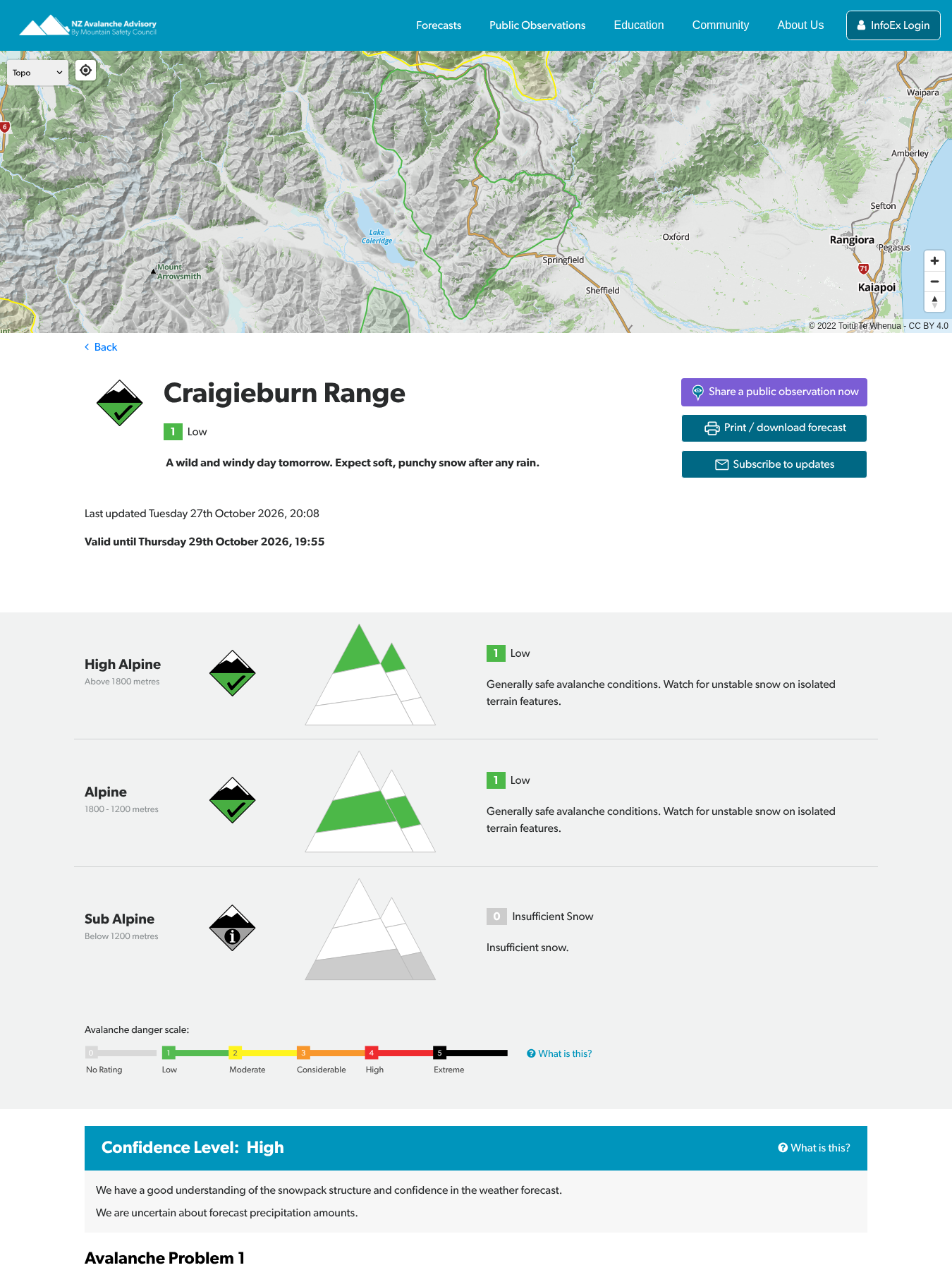
Avalanche forecast posted for Craigieburn Range
New Zealand Mountain Safety CouncilAutomated summaryAn automated avalanche forecast notice has been posted for the Craigieburn Range by the New Zealand Avalanche Advisory. The advisory provides a hazard assessment and downloadable PDF for users to access via an online portal.
 Natural HazardsTramping HikingClimbingGeneral NotificationCorrespondence
8 hours agoWellington
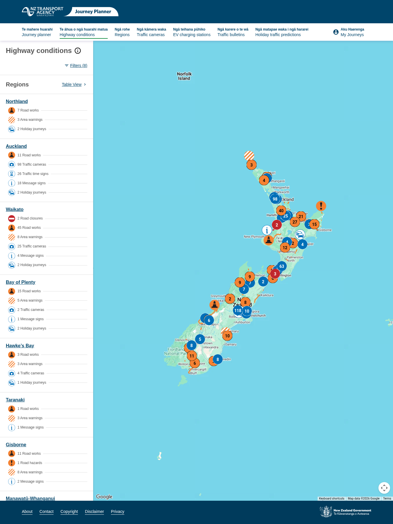
SevereRoad Closure: SH N/A Takapu Road, Tawa
Automated summaryThe road authority has issued a notice that SH N/A Takapu Road in Tawa will be closed nightly from 8pm to 5am, beginning 27 October for approximately four weeks due to construction. Travelers are advised to use detours provided for northbound and southbound journeys and plan extra travel time.
 InfrastructureTransportRoad StoppingCorrespondence
9 hours agoTasman
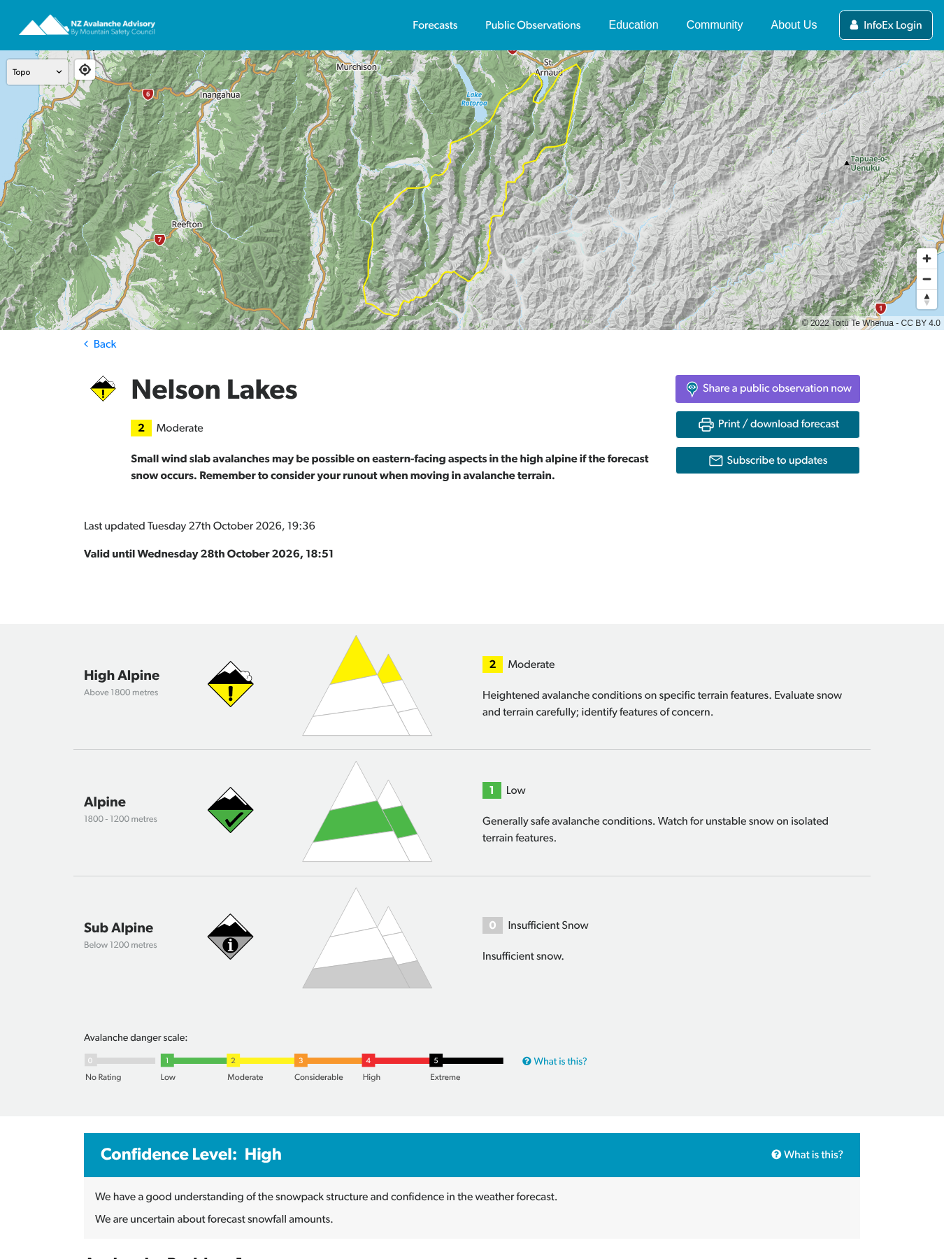
Avalanche forecast posted for Nelson Lakes
New Zealand Mountain Safety CouncilAutomated summaryAutomated email announcing that a new avalanche forecast has been posted for the Nelson Lakes area, providing links to view and download the forecast from the NZ Avalanche Advisory website.
 Natural HazardsTramping HikingGeneral NotificationCorrespondence
9 hours agoHawke's Bay
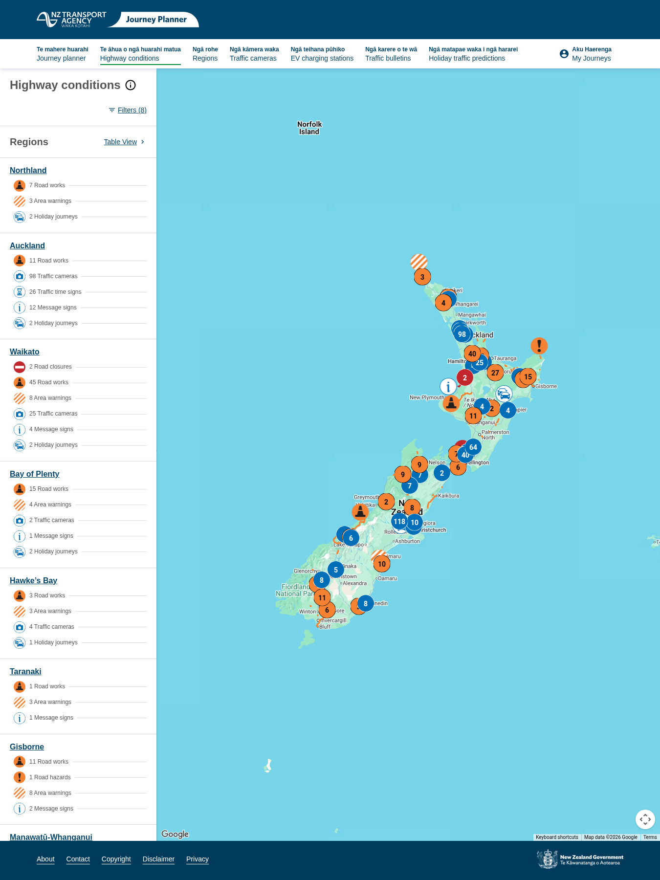
SevereRoad Closure: SH 3 Awakino to Mahoenui (Awakino Gorge)
Automated summaryThe Department of Conservation has issued a closure order for State Highway 3 between Awakino and Mahoenui (Awakino Gorge) from 7 pm to 4 am on Tuesday 27 October to Wednesday 4 November, with full closure until 4 am on Thursday 5 November. Traffic will be managed with a Stop/Go system outside these hours, and motorists are advised to use an alternate route via SH 4. The closure is scheduled to conclude at 4 am on 5 November 2026.
 InfrastructureTransportPublic AccessGeneral NotificationDecision

9 hours agoWellington
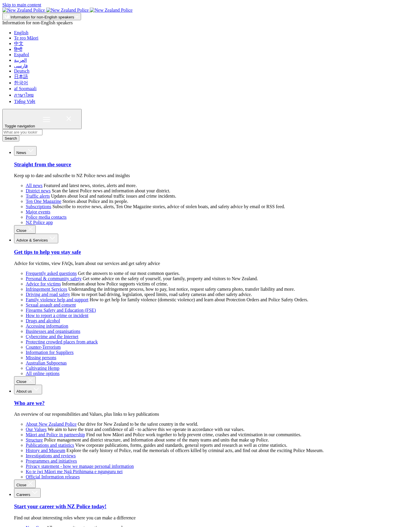
Road closed, SH1 (southbound), Porirua-Tawa
New Zealand PoliceAutomated summaryThe Police Department has announced that State Highway 1 between Porirua and Tawa is closed to southbound traffic following a crash. A diversion through Keneperu Drive is in place while investigators examine the scene.
 TransportInfrastructureRoad StoppingCorrespondence

10 hours ago
NOTAM A5916/26 - NZZC FIR
Civil Aviation Authority of New Zealand (CAA)Automated summaryA NOTAM reporting that a remotely piloted aircraft activity is scheduled to take place within a 1000‑metre radius around a specific location in the NZZC Flight Information Region for the period 27 Oct 26 to 28 Oct 26.
 AirspaceAviationNOTAM
10 hours agoWest Coast
NOTAM A5825/26 - NZZC FIR
Civil Aviation Authority of New Zealand (CAA)Automated summaryNOTAM A5825/26 announces that remotely piloted aircraft will operate within a 1000 m radius of the coordinates 39° 35′ 34″ S 176° 44′ 39″ E (near the Ngakuru River) in the NZZC FIR. The restriction applies to all aircraft in the West Coast region between 27 Oct 2026 20:30 UTC and 28 Oct 2026 00:30 UTC, with amended positions 3.2 NM NW of NZ HS and 4.3 NM WNW of NZ JH.
 AirspaceAviationNOTAM
10 hours agoWaikato
NOTAM A5983/26 - NZZC FIR
Civil Aviation Authority of New Zealand (CAA)Automated summaryThis NOTAM announces a remotely piloted aircraft activity that will operate from 27 September 2026 1900 UTC to 18 December 2026 0400 UTC over a 5.4 NM radius centred at 38°25'35.6S 175°54'03.9E, roughly 11 NM southeast of the New Zealand Topography, with the main flight path over the Waiakato River. The notice includes contact information for the controlling agency.
 AirspaceAviationNOTAM
10 hours agoWaikato
NOTAM A6077/26 - NZZC FIR
Civil Aviation Authority of New Zealand (CAA)Automated summaryA temporary NOTAM was issued for NZZC FIR (North of the South Island Flight Information Region) indicating that remote‑piloted aircraft will operate within a 273 m radius of a specified location at coordinates 38°09'45" S, 174°45'52" E approximately 22 nautical miles south of the New Zealand mainland. The notice is active from 21:00 to 21:30 on 27 October 2026, affecting the West Coast region.
 AirspaceAviationNOTAMDecision
10 hours ago
NOTAM B5183/26 - NZZC FIR
Civil Aviation Authority of New Zealand (CAA)Automated summaryThe NOTAM declares the operation of MIL OPERATING AREA NZM106 over Kaipara, Northland, commencing 27 September 2026 at 1900 UTC and concluding 28 September 2026 at 0300 UTC. It imposes temporary flight restrictions within the stated airspace during that period. The notice informs all aviation users to observe the updated airspace conditions.
 TransportAirspaceAviationNOTAM
10 hours agoOtago
NOTAM B5259/26 - DUNEDIN
Civil Aviation Authority of New Zealand (CAA)Automated summaryThe NOTAM announces that runway 03/21 at Dunedin Aerodrome (NZDN) is closed after the last scheduled flight due to work in progress. The closure is effective from 07:45 to 16:30 on 27 September 2026 and applies to all aircraft operating under briefings 09 and 10. Affected operations must seek alternate arrangements during this period.
 AirspaceTransportAviationNOTAMDecision
10 hours agoOtago
NOTAM B5270/26 - QUEENSTOWN
Civil Aviation Authority of New Zealand (CAA)Automated summaryThis NOTAM informs pilots that at Queenstown aerodrome (NZQN), runway 05 wind direction and speed are estimated, and that the anemometer has been withdrawn for maintenance. It is effective from 18:30 to 19:30 on 26 October 2026.
 AirspaceAviationNOTAMCorrespondence
10 hours agoOtago
NOTAM B5253/26 - QUEENSTOWN
Civil Aviation Authority of New Zealand (CAA)Automated summaryA NOTAM issued for Queenstown (NZQN) states that all grass taxiways and taxiway B between the intermediate holding point Y7 and runway holding point B3 are closed from 26 Jan 2026 19:12 to 27 Jan 2026 20:30 due to unsuitable surface conditions. The notice also indicates that all grass mobile area surfaces are soft, affecting traffic operations during the specified period.
 AirspaceAviationNOTAMCorrespondence
10 hours agoOtago
NOTAM A6105/26 - WANAKA
Civil Aviation Authority of New Zealand (CAA)Automated summaryThe NOTAM indicates that runway 11/29 at WANAKA aerodrome is closed for work during 18:00–19:00 on 27 October 2026. It specifies that personnel and equipment are operating, and provides the operational window. This notice informs pilots and associated users of the temporary closure and limits at the aerodrome.
 AirspaceAviationNOTAM
10 hours agoCanterbury
NOTAM A6098/26 - TEKAPO
Civil Aviation Authority of New Zealand (CAA)Automated summaryA NOTAM announces that a remotely piloted aircraft will conduct extended visual line‑of‑sight flight operations over the Tekapo River area between 19:00 NZST 27 June and 04:00 NZST 28 June, centred on coordinates 44° 11′ 17″ S 170° 22′ 27″ E. It details the aircraft type, operation radius, and that the flight operator will be over TEKAPO (NZTL).
 AirspaceAviationNOTAM
10 hours agoCanterbury
NOTAM F3478/26 - CHRISTCHURCH
Civil Aviation Authority of New Zealand (CAA)Automated summaryThis notice announces that runway 02/20 at Christchurch International Airport is under Work In Progress (WIP) with the north side activated, its effective operating length reduced to 1920 m, and runway 20 is closed for landing with taxiways A4 available for takeoff. The notice is active from 10:00 to 16:00 on 27 February 2026.
 AirspaceAviationNOTAMDecision
10 hours agoCanterbury
NOTAM F3477/26 - CHRISTCHURCH
Civil Aviation Authority of New Zealand (CAA)Automated summaryRuns the runway 02/20 at Christchurch (NZCH) will be closed on 27 October 2026 from 09:40‑10:00 am and 04:00‑04:20 pm for work‑in‑progress (WIP). The NOTAM lists the closure periods and the runway affected, providing pilots with scheduling information for flight operations.
 AirspaceInfrastructureTransportAviationNOTAMCorrespondence
10 hours agoCanterbury
NOTAM F3476/26 - CHRISTCHURCH
Civil Aviation Authority of New Zealand (CAA)Automated summaryA temporary NOTAM for Christchurch aerodrome (NZCH) restricts use of the A runway and A3 area to code C aircraft and smaller during 05:30‑16:20 on 27 Dec 2026, requiring aircraft to follow a vehicle along a temporary taxiway. The notice informs pilots of the operational constraints and alternative route.
 AirspaceAviationNOTAM
10 hours agoCanterbury
NOTAM F3455/26 - CHRISTCHURCH
Civil Aviation Authority of New Zealand (CAA)Automated summaryExposes that aircraft stand 17 at Christchurch Aerodrome is closed due to work in progress, with effect from 27 Oct 2026 21:30 to 28 Oct 2026 00:30 over briefing areas 08 and 09.
 AirspaceAviationNOTAMCorrespondence
10 hours agoCanterbury
NOTAM A6104/26 - RANGIORA
Civil Aviation Authority of New Zealand (CAA)Automated summaryAn official NOTAM for Rangiora Aerodrome announcing that remotely piloted aircraft will operate within a 476 m radius over the specified coordinates from 27 Oct 2026 23:00 to 28 Oct 2026 01:30, with a maximum altitude of 130 ft AGL.
 AirspaceAviationNOTAM
10 hours agoCanterbury
NOTAM A6102/26 - RANGIORA
Civil Aviation Authority of New Zealand (CAA)Automated summaryThis NOTAM announces that pesticide spraying activities will occur at Rangiora aerodrome between 17:00 and 21:00 UTC on 28 January 2026. The notice informs pilots and stakeholders that these operations will affect flight activity within Briefing Area 08 of the aerodrome during that time window.
 PollutionAviationNOTAM
10 hours agoMarlborough
NOTAM A6012/26 - WOODBOURNE
Civil Aviation Authority of New Zealand (CAA)Automated summaryThis NOTAM announces a temporary restriction on the WDI runway 24 at Woodbourne aerodrome, citing a withdrawn runway due to maintenance, effective from 27 October 2026 21:45 to 28 October 2026 00:15.
 AirspaceAviationNOTAMDecision
10 hours agoMarlborough
NOTAM A6003/26 - WOODBOURNE
Civil Aviation Authority of New Zealand (CAA)Automated summaryThe NOTAM announces that runway 06 at Woodbourne aerodrome (NZWB) will be withdrawn for maintenance from 19:15 to 21:45 on 27 October 2026. The notice informs pilots that operations using runway 06 are temporarily prohibited during that period.
 AirspaceAviationNOTAMDecision
That is the latest 60.
Members read the whole river, filter it by place and topic, and get an email when something lands in their area.